|
|
|
|
Seagrass Monitoring in the Florida Keys National Marine Sanctuary
Executive Summary, Annual Report - FY 2000
|
Project Principal Investigators
|
|
|
James W. Fourqurean, Ph.D.
|
Michael J. Durako, Ph.D
|
|
Joseph C. Zieman, Ph.D.
|
|
| Project
Managers
|
|
|
Susie P. Escorcia Leanne M. Rutten
|
|
May 10, 2001
PROJECT OVERVIEW
The general objective of seagrass monitoring in the Florida Keys National Marine Sanctuary (FKNMS) is to measure the status and trends of seagrass communities to evaluate progress toward protecting and restoring the living marine resources of the Sanctuary. The scope and depth of this monitoring effort are without precedent or peer for seagrass ecosystems throughout the world. Specific objectives are: 1) To provide data needed to make unbiased, statistically rigorous statements about the status and temporal trends of seagrass communities in the Sanctuary as a whole and within defined strata; 2) To help define reference conditions in order to develop resource_based water quality standards; and 3) To provide a framework for testing hypothesized pollutant fate/effect relationships through process_oriented research and monitoring. In order to meet these objectives, we have developed these goals for the project:
!
Define the present distribution of seagrasses within the FKNMS!
Provide high-quality, quantitative data on the status of the seagrasses within the FKNMS!
Quantify the importance of seagrass primary production in the FKNMS!
Define the baseline conditions for the seagrass communities!
Determine relationships between water quality and seagrass status!
Detect trends in the distribution and status of the seagrass communities
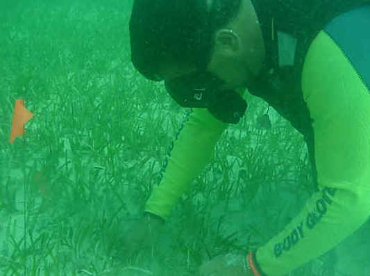
To reach these goals, four kinds of data are being collected in seagrass beds in the FKNMS:
!
Distribution and abundance of seagrasses using rapid assessment Braun-Blanquet surveys!
Demographics of the seagrass communities using leaf-scar counting and population demographics techniques!
Seagrass productivity of the dominant species of seagrass in the FKNMS (Thalassia testudinum) using the leaf-mark and harvest method!
Seagrass nutrient availability using tissue concentration assays
These data are being collected at three different types of sites within the FKNMS:
!
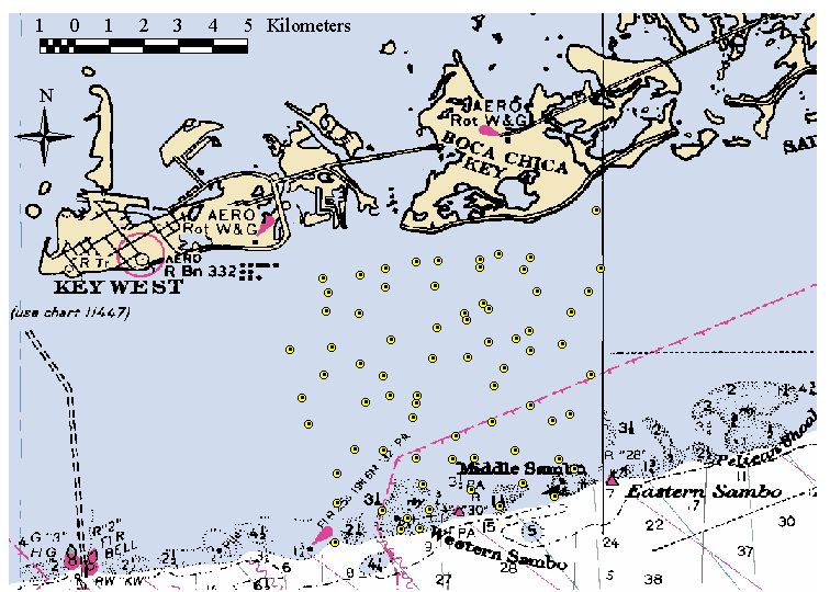
Level 1 Stations: Sampled quarterly for seagrass abundance, demographics, productivity and nutrient availability. These stations are all co-located with the water quality monitoring project�s stations (Figure 1)!
Level 2 Stations: Randomly selected locations within the FKNMS, sampled annually for seagrass abundance, demographics and nutrient availability. Each year, new locations for Level 2 stations are chosen.!
Level 3 Stations: Randomly selected locations within the FKNMS, sampled annually for seagrass abundance. Each year, new locations for Level 3 stations are chosen.
We are assessing both inter-annual and intra-annual trends in seagrass
communities. The mix of site types is intended to monitor trends through
quarterly sampling at a few permanent locations (Level 1 sites) and to
annually characterize the broader seagrass population through less intensive,
one_time sampling at more locations (Level 2 and 3 sites).
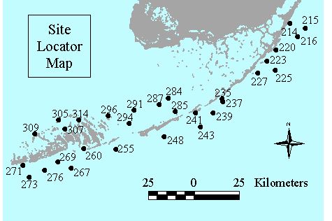
Figure 1. Location of Level 1 seagrass status and trends monitoring sites in the Florida Keys National Marine Sanctuary. Site numbers correspond to water quality monitoring locations.
PROJECT ACCOMPLISHMENTS FY 2000
In 1997, we reported data from quarterly collections from 28 permanent (Level I) stations. In cooperation with the FKNMS Special Permitting Areas monitoring program, two additional permanent Level I stations were established in the Western Sambos and Carysfort Ecological Reserves, bringing the total number of permanent monitoring stations to 30. During FY 1996 through FY 2000 summer sampling of Level 2 and 3 sites was conducted during May - August, and the number of sites visited each year is listed below (Figure 2):
| 1996 | 1997 | 1998 | 1999 | 2000 | |
| No. Level 2 Stations | 65 | 87 | 82 | 78 | 70 |
| No. Level 3 Stations | 141 | 187 | 191 | 258 | 260 |
| Total No. Stations | 206 | 274 | 273 | 336 | 330 |
Figure 2. Location of Level 3 samples taken during FY 1996-2000. Colored polygons indicate areas of intensive surveys; green triangles indicate sampling on the SW Florida Shelf outside of the boundaries of the sanctuary.
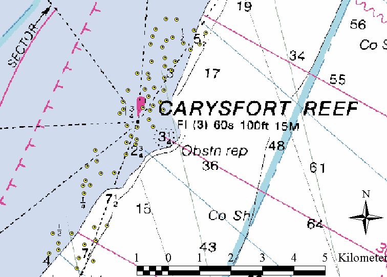
In addition to the level 3 monitoring described above, we provided spatially-intesive data on benthic habitat distributions within the Carysfort and Western Sambos ecological preserve in cooperation with NOAA�s special use zones monitoring effort. For each of these two SPAs, we sampled 40 sites within the SPA and 40 sites in contiguous control areas outside of the SPAs. Station locations for this sampling are shown in Figures 3 and 4.
|
|
|
|
Figure 3. Intensive benthic survey sites at the Carysfort SPA. |
Figure 4. Intensive benthic survey sites at the Western Sambos SPA. |
DATA COMPILATION ON THE WORLD WIDE WEB AND IN CD ROM FORMAT
We have compiled time series data and spatial maps from the monitoring effort for the period 1996 - 2000 both on the web (
http://www.fiu.edu/~seagrass) and on a CD. These formats allow for easy navigation through the data using internet browsing software; either by site for time series graphs or by taxa for distribution data. Limited numbers of the CD are available; please make a request for a copy to Jim Fourqurean at fourqure@fiu.edu.STATUS AND TRENDS IN SEAGRASS COMMUNITIES IN THE FKNMS
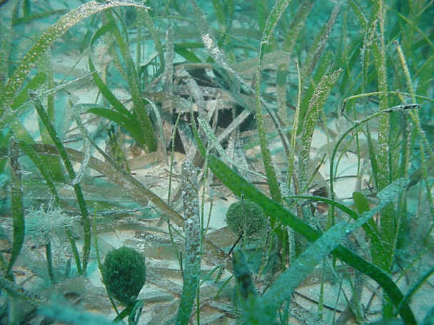
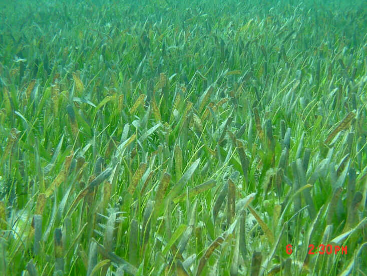
Our surveys have provided clear documentation of the distribution and importance of seagrasses in the FKNMS. The seagrass bed that carpets 80% of the FKNMS is part of the largest documented contiguous seagrass bed on earth. These extensive meadows are vital for the ecological health of the FKNMS and the marine ecosystems of all of south Florida. Maps of spatial distributions can be found on the web or CD.
Synoptic surveys completed to date clearly describe the spatial extent of the seagrass beds, but these surveys were not designed to elucidate trends at this point, because sites were chosen randomly each year. Rather, the original EMAP protocols call for revisiting the exact sites in a second round of sampling. We propose that this second round of sampling be postponed until FY 2003, because the changes in the seagrass communities are expected to occur over this longer time scale. Second round data will allow for the direct comparison of the status of the seagrass communities at over 1000 sampling points. Further, the original sampling design was adequate to address questions at the scale of the FKNMS as a whole, but it did not place enough emphasis on the very-near-shore (within 500 m of the waterline) regions where anthropogenic effects are likely to be concentrated. We have begun to address this nearshore region with a cooperative project funded by the US Army Corps of Engineers as part of the Florida Keys Carrying Capacity Study. In the future, the monitoring effort will need to be adjusted to put more emphasis on this region.
Our permanent monitoring sites have provided valuable data on the inter- and intra-annual variability of seagrass cover and abundance. Time series of species composition, seagrass productivity, nutrient availability and physical parameters can be found for each permanent monitoring site on the web site or the CD. There have been some striking trends in the seagrass communities at these permanent sites: seagrasses were lost completely at 3 of the 30 sites during hurricanes over the last 3 years. At the remaining 27 sites, the benthic communities are relatively stable. There are no common trends across the sites in seagrass cover or community composition. This can be interpreted to mean that there are no regional trends in the health of the seagrass beds represented by the permanent monitoring sites that can be detected with the 6 years of monitoring data. But, manipulative experiments in seagrass beds in south Florida demonstrate that the time course of the response of seagrass beds to eutrophication is on the order of decades, and we do not understand completely the interaction man has with the natural dynamics of these systems. These 30 sites should continue to be monitored on a quarterly basis.
Acknowledgments
This data report represents the dedicated work of many people. Craig Rose, Alan Willsie, Brad Peterson, and Leanne Rutten led the field collection efforts and spearheaded the compilation of the data report; Meredith Ferdie, Dotty Byron, Virginia Cornett, Sean Meehan and Kevin Cunniff collectively put in the thousands of hours in the field and laboratory that went into the collection of these data. The field work was conducted under permits FKNMS-109-98 from the FKNMS, FDEP permit number 1587, FDEP Parks and Recreation Permit number 5-01-25, and permit number 2000078 from the National Park Service.