CONTACT US:
Florida Fish and Wildlife
Conservation Commission
Fish and Wildlife
Research Institute
100 Eighth Avenue SE
St. Petersburg, Florida 33701
727-896-8626
|
|
|
Tampa Bay Estuary Program
100 Eighth Avenue SE
St. Petersburg, Florida 33701
727-893-2765
|
|
|
|
|
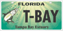
Funding for this project was obtained through Tampa Bay Estuary Program specialty license plate funds.
|
|
|
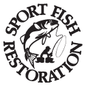
Additional funding for this project was obtained through the Federal Aid in Sport Fish Restoration Fund.
|
|
|
 |
Below is a list of paddling trails in the Tampa Bay area. This list contains trails that are promoted by local, county, and state agencies. There are many more areas within Tampa Bay that offer paddling opportunities.
Before heading out on any paddling adventure, please follow these safety tips:
- 1. WEAR A PERSONAL FLOTATION DEVICE (PFD)! Florida law requires a readily accessible Coast Guard approved PFD for each occupant. Children younger than six years-old are required to wear a PFD.
- 2. Know the waterway conditions and be aware of water levels and currents. Tides and winds can significantly affect the difficulty of a trip. Under normal conditions, allow a minimum of two miles per hour paddling time.
- 3. FILE A FLOAT PLAN AND LEAVE IT WITH A RELIABLE PERSON. A float plan contains information about your trip in the event that you do not return as scheduled. This includes a description of the vessel(s), names of all paddlers, planned course and stops, and an estimated time of return. Ask the person to notify the Coast Guard or local authorities if you do not return as scheduled. Don't forget to get in touch with your contact person and let them know when you return
- 4. Bring plenty of food and water. Drinks should be in non-breakable containers . Food and gear should be stored in watertight containers. For day trips, 1/2 gallon of water per person in recommended. For overnight trips, one gallon of water per person each day is recommended.
- 5. Bring sunscreen and insect repellent. Wear sunglasses, a hat, and long sleeves and pants even on cloudy days. Long sleeves and pants also helps prevent insect bites.
- 6. Watch for motorboats. Stay on the right and turn into the boat's wake. Respect anglers by giving them plenty of room.
- 7. Bring a cell phone or VHF radio. Cell phones are great for staying in communication, but coverage may be sporadic depending on your specific location.
- 8. Respect wildlife. Do not approach or harass wildlife, as they can be dangerous. It is also illegal to feed them.
|
REGIONAL TRAILS
|
Florida Circumnavigational Saltwater Paddling Trail
The Florida Circumnavigational Saltwater Paddling Trail is divided into 26 segments. Each segment is unique, ranging from the remote Big Bend Coast and Everglades and Florida Bay wilderness, to the more urbanized coastlines of Pinellas County and Fort Lauderdale. Three segments of the Florida Circumnavigational Trail follow the coastline of Tampa Bay. Segment seven runs from the Cross Florida Greenway spoil island near Yankeetown to Anclote Key State Park, Segment Eight runs from Anclote Key State Park to Fort De Soto County Park, and Segment Nine starts at Fort De Soto and ends at Lido Beach.
Visit the Florida Circumnavigational Trail Web site for more information.
Segment 7 Cross Florida Greenway spoil island near Yankeetown
to Anclote Key State Park
Segment 8 Anclote Key State Park to Fort De Soto
Segment 9 Fort De Soto County Park to Lido Beach)
|
Back to Top
Florida Greenways and Trails
The Office of Greenways and Trails (OGT) works to establish a statewide system of greenways and trails for recreation, conservation, and alternative transportation. This includes the creation of designated paddling trails . For more information about greenways and trails in Florida, visit Florida Greenways and Trails.
Below is a list of designated paddling trails in the Tampa Bay area.
Pithlachascotee (Cotee) River
Alafia River (PDF, 428 kb)
Hillsborough River
Little Manatee River (PDF, 602 kb)
Upper Manatee River
The Office of Greenways and Trails, in conjunction with the Florida Park Service, Florida Professional Paddlesports Association, and Visit Florida, has produced a brochure highlighting Florida's paddling trails, Florida Paddling Trails Guide (PDF, 8 MB).
|
Paddle Manatee
Manatee county has developed a series of marked, connected paddling trails throughout its waterways. Many of the trails connect to other paddling trails, such as the Florida Circumnavigational Trail. Trails have been created for Bishop's Harbor, Terra Ceia Bay, Upper Manatee River, Braden River, and Palma Sola Bay.
Manatee County and the Manatee County Citizen Trail Committee (CTC) have developed a guide, highlighting the local history, camping opportunities, and private launch opportunities, area wildlife, and provides paddler safety information and a resource directory.
For more information about the Paddle Manatee Guide, visit the Manatee County Natural Resources Department's Paddle Manatee Web site.
|
MARKED, MANAGED TRAILS
|
Weedon Island
Situated along the shore of Old Tampa Bay, Weedon Island Preserve is approximately 3,700 acres of natural lands including mangrove swamps, intertidal flats and pine flatwood uplands. Two paddling trails, the North Trail and South Trail, are available for the public to enjoy at Weedon Island Preserve. Both trails are best accessed during high tides. Be sure to check a tide chart before venturing out on the paddling trails.
Find out more information about Weedon Island Preserve.
South Trail (PDF, 332 kb)
North Trail (PDF, 169 kb)
NOTE: The North Paddling Trail is temporarily closed due to nearby construction activities. Click here for more information about the trail's status.
|
Fred Howard Park
Dedicated in 1996, Fred Howard Park is a popular destination for residents and visitors to north Pinellas County. Visitors to the park can access the white sandy beach via a one-mile causeway. The causeway is a popular location for fishing, sunbathing, and exercising. This park also boasts two paddling trails, accessed via the canoe luanch near the park entrance. Paddlers should note that a good portion of the paddling trails are not accible at low tide. It is best to begin any trip at the middle of an incoming tide.
Find out more information about Fred Howard Park.
Park Map (PDF, 944 kb)
|
Caladesi Island State Park
Caladesi Island is one of the many barrier islands along the Pinellas County coast. This state park boats one of the tops beaches in North America (voted number one in 2008), as well as several hiking trails that take visitors through several different natural communities as they move from the shoreline to the island's interior. The mangrove-covered kayak trail winds from the park's marina to St. Joseph Sound and back. Visitors can rent kayaks at the park or paddle over from the Dunedin Causeway.
Find out more information about Caladesi Island State Park.
Paddling Trail (PDF, 306 kb)
|
Upper Tampa Bay Park
Upper Tampa Bay Park can be found at the mouth of Double Branch Creek next to Old Tampa Bay. This park has remained relatively untouched while the area around it has become developed. Visitors to this park can walk through a variety of habitats ranging from shallow, fresh-water ponds to pine flatwoods to mangrove forest. Two marked kayak trails along Double Branch Creek provide paddlers with a chance to get up-close to many estuary species that call this area home.
Find out more information about Upper Tampa Bay Park.
Paddling Trail (PDF, 306 kb)
|
Cockroach Bay
Contrary to what folks may think, Cockroach Bay is not named for the insect, but for the horseshoe crabs that were observed by Spanish explorers. This area is part of the Cockroach Bay Aquatic Preserve. This managed area is dominated by mangrove forest and salt marsh. This area is an extremely popular with shallow-water fishermen. There are two markes paddling trails (one to the north of the boat ramp and another to the south) with another trail in the planning stage.
Find out more information about Cockroach Bay Aquatic Preserve (658 kb).
|
If you have any questions, comments, or suggestions about this Web site, please e-mail us at Boating_Guides@MyFWC.com.
Would you like to receive notices of changes to this Web site and the Boating and Angling Guide to Tampa Bay? If so, please e-mail us and include SUBSCRIBE-TAMPA in the subject line.
|


