CONTACT US:
Florida Fish and Wildlife
Conservation Commission
Fish and Wildlife
Research Institute
100 Eighth Avenue SE
St. Petersburg, Florida 33701
727-896-8626
|
|
|
|
|
Partial funding for this project was obtained through the Federal Aid in Sport Fish Restoration Fund.
|
|
|
 |
|
The online interactive Boating and Angling Guides provides more information than is found on the printed Guides for their respective areas. Additional information not provided on the printed guides, such as paddling trails, local fishing regulations, native habitats and animals and managed areas, are included on these sites. Moreover, the Resource Directory is enhanced to include Web links for listed organizations. In addition to offering factual information, maps of various scales and sizes are available for download or viewing on screen. These maps focus on popular areas and contain more detailed information (spatial extent of seagrasses and corals, aids to navigation, managed areas, mooring buoys, etc.) than what is shown on the printed Guides covering the same area
|
|
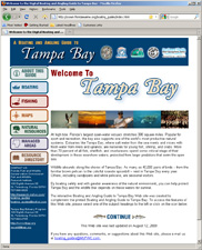
Online Boating and Angling Guide to Tampa Bay
The online Boating and Angling Guide to Tampa bay was created in 2009 to complement the redesign of the Boating and Angling Guide to Tampa Bay. This Web site contains two interactive maps of the BAG to Tampa Bay, five detailed maps, and seven boating zone maps. Additional information about 14 paddling trails, 31 Clean Marinas and pumpouts, 63 boat ramps, and 34 fishing piers is provided. Fish identification sheets for groupers, mackerels and greater amberjack/banded rudderfish can be downloaded and printed.
|
|
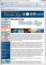
Online Boating and Angling Guide to the Florida Keys
The online Boating and Angling Guide to the Florida Keys was created in 2011. This Web site combines the printed Boating and Angling Guides to the Upper, Middle, and Lower Keys into one location. Six interactive maps are available here, as well as five detailed maps, 40 marine zone maps. Additional information about 53 boat ramps, 24 fishing piers/bridges, and 19 DEP Clean Marinas with pump outs is provided. Fish identification sheets for groupers, mackerels, snappers and grater amberjack/banded rudderfish can be downloaded and printed.
|
|
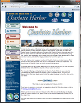
Online Boating and Angling Guide to Charlotte Harbor
The online Boating and Angling Guide to Charlotte Harbor was created in 2012 to complement the redesign of the Boating and Angling Guide to Charlotte Harbor. This Web site contains two interactive maps of the Boating and Angling Guide to Charlotte Harbor, four detailed maps, and six boating zone maps. Additional information about three regional paddling trails, 30 marinas, 24 boat ramps, and 16 fishing piers is provided. Fish identification sheets for groupers, mackerels and greater amberjack/banded rudderfish can be downloaded and printed.
|
|
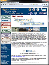
Online Boating and Angling Guide to Nassau and Duval Counties
The online Boating and Angling Guide to Nassau and Duval Counties was created in 2012 to complement the redesign of the Boating and Angling Guide to Nassau and Duval Counties. This Web site contains two interactive maps of the Boating and Angling Guide to Nassau and Duval Counties, four detailed maps, and five boating zone maps. Additional information about three regional paddling trails, 17 DEP Clean Marinas, 24 boat ramps, 16 fishing piers, and 16 canoe/kayak launches is provided.
|
If you have any questions, comments, or suggestions about this Web site, please e-mail us at Boating_Guides@MyFWC.com.
Would you like to receive notices of changes to this Web site and the Florida Boating and Angling Guide Series? If so, please e-mail us and include SUBSCRIBE-BAG in the subject line.
|