CONTACT US:
Florida Fish and Wildlife
Conservation Commission
Fish and Wildlife
Research Institute
100 Eighth Avenue SE
St. Petersburg, Florida 33701
727-896-8626
|
|
|
Charlotte County
UF/IFAS Extension
Florida Sea Grant
25550 Harbor View Rd #3
Port Charlotte, Florida 33980
941-764-4340
|
|
|
|
|
Funding for this project was obtained through grants from the West Coast Inland Navigation District and Charlotte County.
|
|
|
Additional funding for this project was obtained through the Federal Aid in Sport Fish Restoration Fund.
|
|
|
 |
Only a small number of the boating regulatory zones in the Charlotte Harbor area are shown on the maps below. Please look out for posted signs and follow instructions. When in doubt, slow down.
The maps were designed for speedy download, viewing on screen, and printing on your desktop printer.
To download a copy to your computer, place your cursor over the image, click your right mouse button, and then click the "Save Link As" option. After a dialogue box appears, you can select the destination of where you want the image downloaded and, if you choose, a new name for the file. Then click "Save" .
Adobe Reader is needed to view the maps below. If you do not have Adobe Reader, a copy can be downloaded from Adobe's Web site.
|
(PDF, 2.21 MB)
|
(PDF, 1.31 MB)
|
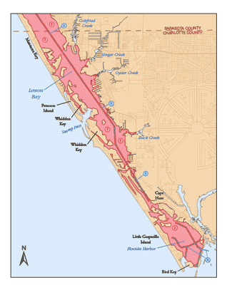
Lemon Bay: Fish and Wildlife Conservation Commission (FWC) manatee protection zones in Lemon Bay from the Sarasota/Charlotte County line to the Gasparilla Causeway are shown on this map. A Fish and Wildlife Commission boating safety zone around Cape Haze is also shown.
|
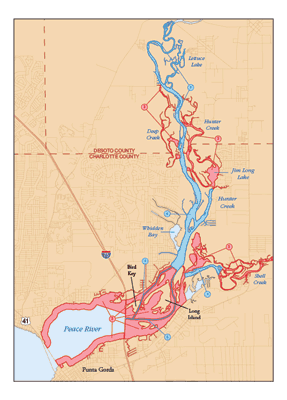
Peace River: FWC manatee protection zones around Punta Gorda, Port Charlotte, and the Peace River are shown here.
|
(PDF, 865 KB)
|
(PDF, 713 KB)
|
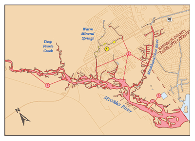
Myakka River: Pictured here are FWC manatee protection zones in the Myakka River and Warm Mineral Springs.
|
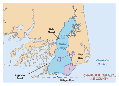
Cape Haze: This map shows FWC manatee protection zones around Cape Haze and inside Turtle Bay.
|
(PDF, 841 KB)
|
(PDF, 525 KB)
|
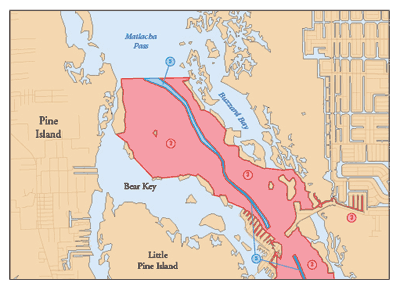
Matlacha Pass: Pictured here are FWC manatee protection zones in Matlacha Pass north of the Matlacha Pass bridge crossing.
|
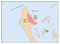
Cayo Coasta: FWC manatee protection zones in Cayo Costa State Park are shown here.
|
|
If you have any questions, comments, or suggestions about this Web site, please e-mail us at Boating_Guides@MyFWC.com.
Would you like to receive notices of changes to this Web site and the Boating and Angling Guide to Charlotte Harbor? If so, please e-mail us and include SUBSCRIBE-CHARLOTTE in the subject line.
|