CONTACT US:
Florida Fish and Wildlife
Conservation Commission
Fish and Wildlife
Research Institute
100 Eighth Avenue SE
St. Petersburg, Florida 33701
727-896-8626
|
|
|
City of Jacksonville
Parks and Recreation
214 N. Hogan Street
Third Floor
Jacksonville, Florida
32202
904-630-2489
|
|
|


|
|
This project was funded in part by a grant awarded by the and .
|
|
|
Additional funding for this project was obtained through the .
|
|
|
 |
The maps of the Boating and Angling Guide to Nassau and Duval Counties (formerly the Boating and Angling Guide to Duval County) has proved to be a valuable resource for boaters and anglers, as well as teachers and students.)
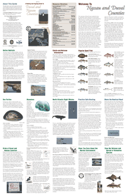
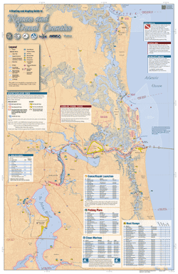
The Maps section of this Web site provides the Boating and Angling Guide to Nassau and Duval Counties in various formats. On this page, full-sized copies (22-inches by 34-inches) of the guide are available for you to download and view on your computer.
On the Interactive Maps page, both sides of the guide are provided in a format that will allow you to zoom-in and –out and move around the map. Page-sized maps of popular recreation areas are provided on the Detailed Maps page. Maps of boating regulations zones are available on the Marine Zones page.
The maps included on this Web site should not be used for navigation. For local navigation, boater's should consult NOAA Charts 11489, 11490, 11491, 11492, 11502 and 11503. For more information about NOAA Nautical Charts, please visit NOAA's Office of Coast Survey.
|
FULL-SIZED MAPS
Full-sized copies of the guide in PDF format are available below for downloading. Each side of the guide measures 22-inches by 34-inches.
NOTE: The Boating and Angling Guide below is for reference purposes only. The information provided was current as of the data of the guide was last updated and some of the information depicted may have changed between then and now. Please use caution when traversing these areas.
To view these maps you will need Adobe Reader. If you do not have Adobe Reader, a copy of this free software can be downloaded from Adobe's Web site.
|
Side A, PDF, 8 MB
|
Side B, PDF, 14.5 MB
|
|
If you have any questions, comments, or suggestions about this Web site, please e-mail us at Boating_Guides@MyFWC.com.
Would you like to receive notices of changes to this Web site and the Boating and Angling Guide to Nassau and Duval Counties? If so, please e-mail us and include SUBSCRIBE-DUVAL in the subject line.
|