CONTACT US:
Florida Fish and Wildlife
Conservation Commission
Fish and Wildlife
Research Institute
100 Eighth Avenue SE
St. Petersburg, Florida 33701
727-896-8626
|
|
|
City of Jacksonville
Parks and Recreation
214 N. Hogan Street
Third Floor
Jacksonville, Florida
32202
904-630-2489
|
|
|


|
|
This project was funded in part by a grant awarded by the and .
|
|
|
Additional funding for this project was obtained through the .
|
|
|
 |
This section provides detailed maps for several popular regions of Nassau and Duval counties. These maps provide the same information as, and look like, the printed Boating and Angling Guide to Nassau and Duval Counties. The maps were designed for speedy downloading, viewing, and printing on your desktop printer.
To download a copy to your computer, place your cursor over the image, click your right mouse button, and then click the "Save Link As" option. After a dialog box appears, you can select the destination of where you want the image downloaded to and if you choose, select a new name for the file. Then click "Save."”
Adobe Reader is needed to view the maps below. If you do not have Adobe Reader, a copy can be downloaded from Adobe's Web site.
|
|
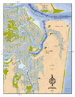
St. Marys River, Cumberland Sound, Fernandina Beach, Amelia Island, Amelia River:
This map shows the coastal waters from the St. Marys River south to the SR 200 bridge over the Amelia River. Included in this map are Fort Clinch State Park, Fort Clinch Aquatic Preserve, and Fernandina Beach. This map also shows the locations of three public access boat ramps, two DEP listed Clean Marinas (both with pumpouts), and two fishing piers.
PDF, 3.44 MB
|
|
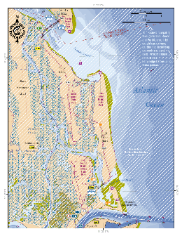
Talbot Islands:
This map shows the coastal waters from Nassau Sount to the mouth of the St. Johns River. Included in this map are Amelia, Black Hammock, Talbot, and Little Talbot islands; Amelia, Big Talbot, Little Tabot, and Fort George Island Cultural State Parks; and Nassau River-St. Johns River Marshes Aquatic Preserve. This map also shows the locations of four public access boat ramps, two DEP-listed Clean Marinas, one fishing pier, and three canoe/kayak launches.
PDF, 3.95 MB
|
|
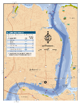
St. Johns River/Downtown Jacksonville:
This map shows the St. Johns River from Reddie Point to the Fuller Warren Bridge. This map shows the locations of three public access boat ramps, one DEP-listed Clean Marina with pumpout, three fishing piers, and a canoe/kayak launch.
PDF, 2.46 MB
|
|
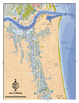
Pablo Creek, San Pablo River, :
This map shows the coastal waters around San Pablo River from the St. johns River south to the SR 202/Butler Blvd. Bridge. Included in this map are Mayport, Atlantic Beach, and Jacksonville Beach. This map also shows the locations of five public access boat ramps, four DEP-listed Clean Marinas, four fishing piers, and three canoe/kayak launches.
PDF, 3.28 MB
|
If you have any questions, comments, or suggestions about this Web site, please e-mail us at Boating_Guides@MyFWC.com.
Would you like to receive notices of changes to this Web site and the Boating and Angling Guide to Nassau and Duval Counties? If so, please e-mail us and include SUBSCRIBE-DUVAL in the subject line.
|
